Asking for a Little Help
Asking for a Little Help
I'm having trouble with GMP2BMP so I was wondering if some kind soul would be willing to convert the attached gmp to a grayscale png file.
- Attachments
-
 Contest_Map_1.zip
- (714.36 KiB) Downloaded 134 times
Hawk
-
Silverback
- Watchman
- Posts: 84
- Joined: Mon Nov 13, 2006 6:57 pm
Re: Asking for a Little Help
Well I tried but results don't look very good  but the map looks very flat when I look at the pictures so may not be what you were expecting)
Tried to change the contrast etc. on the file but doesn't look promising. hopefully someone else can do better.......
I've also attached the colour version in zip format
Tried to change the contrast etc. on the file but doesn't look promising. hopefully someone else can do better.......
I've also attached the colour version in zip format
- Attachments
-
- cm1.zip
- (27.94 KiB) Downloaded 133 times
-
- B&W
Re: Asking for a Little Help
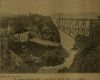
I appreciate it Silverback  but both versions are flat. There is suppose to be mountains. It should look something like this.
You can kind'a see the mountains in that shot. 
- Contest map.png (48.53 KiB) Viewed 3709 times
Hawk
Re: Asking for a Little Help
It just dawned on me. When I did that contest I added the mountains myself. 
I wonder if this gmp would come out with the mountains?
This should be after I added the mountains in the RT3 editor.
I wonder if this gmp would come out with the mountains?
- Paph I.zip
- (2.85 MiB) Downloaded 159 times
This should be after I added the mountains in the RT3 editor.
Hawk

Re: Asking for a Little Help
That one just extracts as a blank grey square for me.
Complete express car and caboose packs - Custom double tankers (Alternative F era) - Pennsy H3 Consolidation
 Слава Україні! Героям слава!
 Слава Україні! Героям слава!
 -
RulerofRails
- CEO
- Posts: 2063
- Joined: Sun Dec 08, 2013 1:26 am
Re: Asking for a Little Help
Um, I don't think it's possible to extract a grayscale height-map, that tool is to rip the paint-job off the map. See this: http://hawkdawg.com/forums/viewtopic.php?p=41210#p41210
If you have enough patience and perseverance, you might be able to create your own in the game. I can't speculate if it will be fit for your purpose though.
1st part:
Using the lake tool we can see "heights" when Shift-clicking. (This doesn't place a lake). One could choose intervals, find them, then mark them, for example with the labels in the place station list.
2nd part:
Now, paint the whole thing Black. Then use the Lighten/Darken tool. With bucket fill and while holding Ctrl you can lighten all Non-contiguous points above/below a certain height. So start at either top or bottom and follow your markers to get the intervals.
Might work.
Re: Asking for a Little Help
It's probably possible to extract the heightmap data from the .gmp by working directly with the hex code. You could then, with a fair mount of messing around, assign greyscale values to various height ranges and compose an image out of that lot. I can see how it could work in principle.
Complete express car and caboose packs - Custom double tankers (Alternative F era) - Pennsy H3 Consolidation
Слава Україні! Героям слава!
Слава Україні! Героям слава! Re: Asking for a Little Help
RoR - I forgot all about that topic you linked to. Thanks for the refresher.
I was hoping to use that map to create a map for Transport Fever. Looks like it's not going to happen.
Thanks for all the help folks.
I was hoping to use that map to create a map for Transport Fever. Looks like it's not going to happen.
Thanks for all the help folks.
Hawk