Right, more experiments.

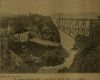
Just for fun I whipped up a small map of the Parenzana route, just to see if it had potential for a workable scenario. After a bit of thinking about the results that RT3 generated, combined with some PM chatting with RoR, I figured I should run the ultimate test for accuracy.
The natural resolution of standard DEM's is 1200 pixels per degree of latitude or longitude. So, to see what RT3 is capable of making from a DEM under optimum conditions, the way to go is a simply crop out a 1025x1025 chunk of DEM and save it as a heightmap. This equates to a real life area that is 0.854 degrees in latitude and longitude ranges.
DEM's are tiled at even 5 degree increments, so for this test I grabbed 39_03 (the DEM for the general Parenzana area) and cropped out my 1025x1025 chunk, from 45N to 45.854N and from 13.4E to 14.254E. This was then saved as BMP, and MicroDEM automatically saved it as 693x1025. I assume this is because MicroDEM is coded to use some reference geoid when saving cropped DEM's, and thinks this is the correct aspect ratio for that general latitude. According to the lat/long calculator I use the aspect ratio should be a bit different, and for RT3 it needs to be based on 64+1 anyway, so I scaled it out to 705 wide using the procedure detailed in the previous post.
Ran a few test imports to RT3 editor, and for now have settled on an overall height modifier of 2.785, with a mountaintop modifier of 1, and smoothing of 0. The overall height modifier was chosen to give 2 RT3 height units per metre of elevation, at the known elevations of Baldasi and Grosnjan. This means the rest of the map can be quickly checked for accuracy of heights, as long as you have something like Google Earth to give you elevations and you know how to multiply by 2 (which is something I happen to know). The results are educational.
1/ In large areas of shallow slopes, the DEM data will produce a series of flat terraces. These are set approximately 77 height units apart. In other words,
a standard DEM will, under optimum conditions, only give the heights of shallow slopes in about 40 metre steps. For anyone who still thinks in feet and inches, that's about 130 feet.
This is as accurate as the standard 3 arc second DEM series gets. Anything that looks more accurate than that is probably an illusion.
Edit: The above turns out to not be correct. It was the result of the faulty elevation table that was supplied for MicroDEM. With a correctly functioning elevation table it is possible to get a resolution of 1 metre (although that small an interval is not actually useful).
2/ How can we tell it's probably an illusion? Well, on a shallow slope you will have large areas of the same colour pixels on your DEM. This is why it generates terraces when imported into RT3. The terraces are the areas in between the contour lines defined by the pixel colours. In real life those areas are sloped, but when limited by a pixel's colour they all turn out the same until you get to the next step.
3/ This is on a maximum sized test map of a comparatively small area. If making a map of a larger real life area, or making a smaller map of it, the resolution will be reduced. This means that, in general, on most maps, the heights will not even be accurate to 40 metres.
4/ Obviously the ocean is always accurate, since it's height is always 0. Not even DEM's and RT3 can screw that up. However, low elevations that are not 0 are out of whack by quite a bit. For example, on this test map I know that Livade has an elevation of approximately 10 metres. That would be 20 RT3 height units at this scale. However, the map generates with the valley floor at a height of 77 units. In other words the DEM is telling RT3 that the valley floor is roughly 30 metres higher than it really is. This comes back to the 40 metre resolution on shallow slopes. It knows it aint 0, but it can't tell it's only 10 metres, so it rounds up to 40. Genius stuff.

5/ So where are we, then? The standard DEM series we all know and love
is built of out 130 foot tall Lego blocks. We may have a lovely .dbf file that theoretically allows 1 metre height resolution, but there's no way you will get that from the standard DEM series. The standard DEM series will only use 1/4 of the .dbf file's capabilities, even under optimum conditions, and far less than that under less than optimum conditions.
6/ This is without using smoothing on import. Using smoothing on import will exponentially borkificate the 130 foot Lego blocks, and your resulting heights will be anyone's guess.

7/ Ok, is it possible to get more accurate results? Yes, in theory, if you're lucky. There are all sorts of data floating around the world of science and engineering. Surveys of all sorts of things are routinely done to an accuracy way beyond anything we'll ever need for RT3. The hard part is getting the right data, in a usable form, and without forking out hundred of thousands of bucks for it.
8/ Or if you're a hard core lunatic who wants a map to be as good as it can get in a few critical places, it would be possible to start with the DEM's output, import that into RT3, and then use the RT3 terraforming tools in combination with Google Earth to wallop a few chunks of the map into shape. A somewhat daunting prospect, but frankly no worse than doing RT3 rivers anyway.
9/ Having said all of that, I will say that the results at this large a scale are still quite usable, and the main features are clearly recognisable. The 1.06 test map is attached. This has a few basics thrown in, but it only currently suitable for sandboxing.
Edit: Zip removed. The following posts will explain why.
I'll get onto testing the old RT3 Map builder as well, and see how that compares for accuracy.